
Ghost Beach
Community: Port Hawkesbury
Length: 7.5 km (4.7 mi) return Hiking Time: 2+hr Type of Trail: crushed stone, natural surface, rock Uses (no snow): walking, ATVs Uses (sno...
Port Hastings to Long Point


Length: 22 km (13.75 mi) – Canso Canal to Chisholm’s Brook, Long Point (linear)
Cell Service: Yes
Dogs Permitted: On Leash
Trail Surface: natural, beach cobble, hard surface, gravel
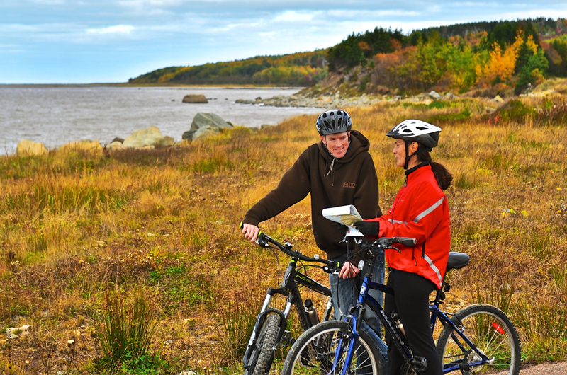
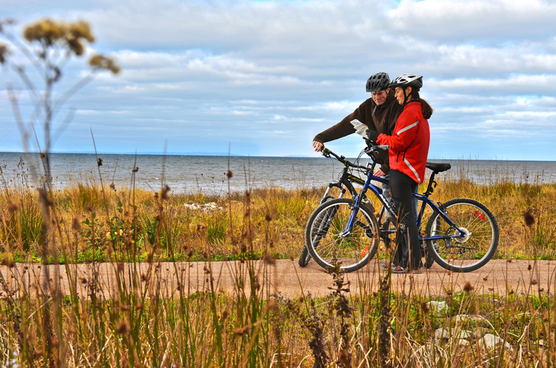
The Ceilidh Coastal Trail section of the Celtic Shores Coastal Trail begins at the entrance to Cape Breton Island, at the Trans Canada Trail Pavilion and Trailhead Kiosk beside the Canso Canal. The first kilometre of this 22-km (13.75-mi) multi-use trail is gravel-surfaced and single track, before entering a 2-km, hikeable tide-washed section. This section is “hike a bike”, but the scenery is amazing with the Strait of Canso on one side and beautiful Long Pond on the inland side. Cyclists are recommended to access the trail in Troy along Route 19.
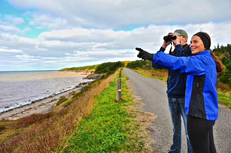
The next 4.5 km (3 mi) of the trail is undeveloped rail bed. Though the surface is a bit too rough for cyclists, its worth the walk, as you will often have a front row view of ocean-going tankers, tugs, sailboats, yachts and barges approaching the Canso Canal locks. Depending on the season, you may see people or the occasional eagle fishing along the shoreline. The next 1.5 km (1 mi) of trail is a gravel-surfaced double track, followed by 2.5 km (1.5 mi) of paved trail (recycled asphalt). The final 11 km (7 mi) is gravel trail, double track. In addition to the stunning coastal views, the trail features wayfinding signage and interpretive panels, which outline the history and culture of the surrounding communities.
Trailhead: After crossing the Canso Causeway at the entrance to Cape Breton, you’ll see a parking area and the Trans Canada Trail Pavilion and Trailhead Kiosk on your left. Walk the length of the parking lot and continue along the right side of the chain link fence surrounding the Canso Canal property. The trail continues along what is known as a ‘parallel bar,’ which is a long, thin ribbon of sand, gravel and rocks.
Cyclists are recommended to access the trail from the Troy Station Trailhead Kiosk along Route 19. 71 Hwy 104, Port Hastings.
Troy Station Trailhead: 45.691553, -61.439462 (civic: 1020 Route 19)
Community: Port Hawkesbury
Length: 7.5 km (4.7 mi) return Hiking Time: 2+hr Type of Trail: crushed stone, natural surface, rock Uses (no snow): walking, ATVs Uses (sno...

Region: Cape Breton’s South Coast
Community: Port Hawkesbury
The Port Hawkesbury Civic Centre is a focal point in the region, serving residents, tourists and the business community. It is a state of th...

Region: Cape Breton’s South Coast
Community: Port Hawkesbury
The Strait of Canso Yacht Club was established in 1964. As a member-run facility, the club depends on its members to donate their time and t...

Region: Cape Breton’s South Coast
Community: Port Hawkesbury
Traditional quilts, ready-made and custom; all sizes available. ...

Region: Canada’s Musical Coast
Community: Port Hawkesbury
Conveniently located in the Town of Port Hawkesbury, this wonderful system of all-season trails will appeal to both the avid and casual hike...

Region: Canada’s Musical Coast
Community: Judique
Experience the enchanting beauty of nature by joining us for a guided walk in the woods at Twisted Roots Farm. Walk alongside our herd of go...
Canada's Musical Coast, nestled along the western shores of Cape Breton Island, offers some of the most breathtaking sunsets in the country.
Snowmobiling offers exhilarating experiences across winter landscapes, but safety must always be a priority.
Atlantic lobster from Cape Breton Island is renowned for being the freshest and some of the tastiest lobster in the world.
Tap your toes to fiddle tunes at a Ceilidh. See authentic Acadian crafts at Les Trois Pignons. Take a piece of Mi’kmaq culture home with you at a drum-making workshop. On Cape Breton Island, culture is all around you just waiting to be explored!
When the adventurous duo Chris and Jan from A for Adventure received the call to explore Cape Breton Island’s magical Waterfall Season, they packed their gear, laced up their boots and set their sights on some of Nova Scotia’s most breathtaking scen
Cape Breton Island Ambassadors Davey and Sky were selected by Explore Canada as official ambassadors for their home province of Nova Scotia.
Cape Breton Island Ambassador Ashley George was selected by Explore Canada as an official ambassador for her home province of Nova Scotia.
Discover the magic of winter in Port Hawkesbury, where adventure, great food and entertainment come together for the perfect seasonal getaway.
When Cape Breton Island dons its blanket of snow, it transforms into a winter wonderland bursting with adventure and serene beauty.


